Clear File World Series 4-Sheet Set / Tokyo Cartographic
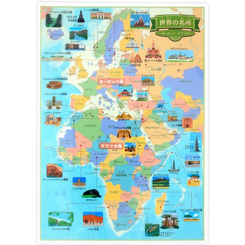
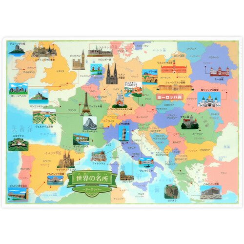
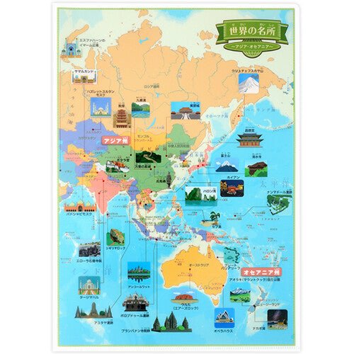
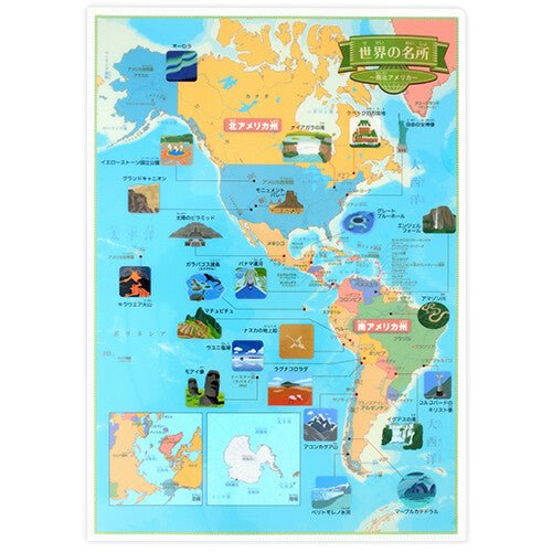
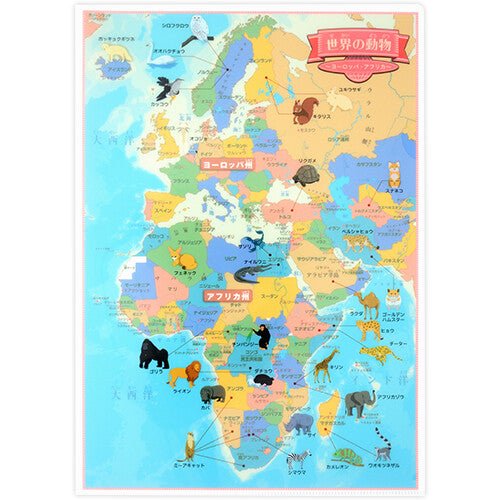
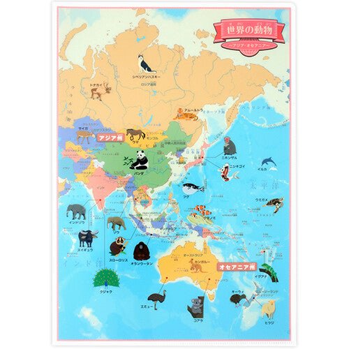
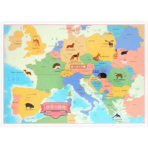
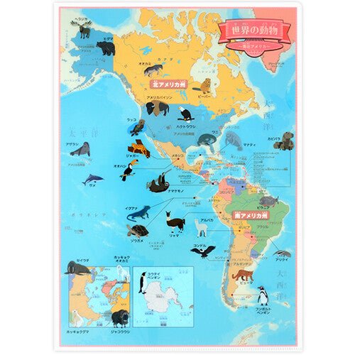
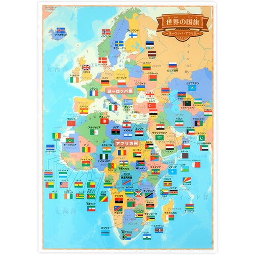
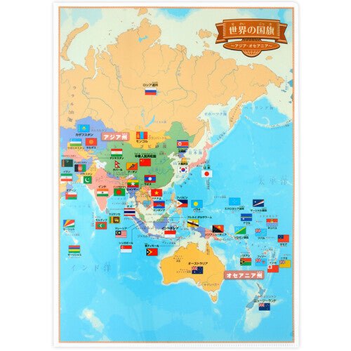
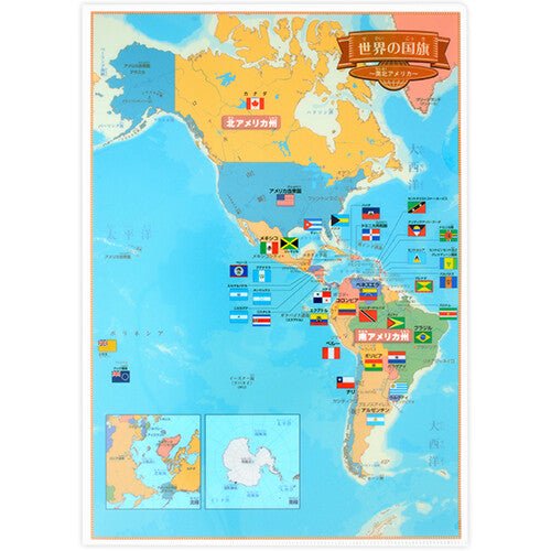
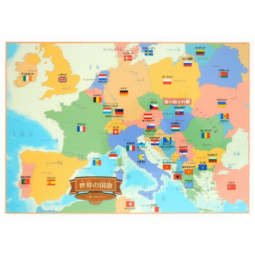
The Clear File World Series 4-Sheet Set by Tokyo Cartographic brings educational world geography to A4 clear file folders designed for learning about countries, landmarks, animals, and national flags. Each set contains four clear files divided into world regions: Europe/Africa, Asia/Oceania, North and South America, and Europe (enlarged). Map sides feature color-coded countries with country names, capital names, and major mountain ranges and rivers.
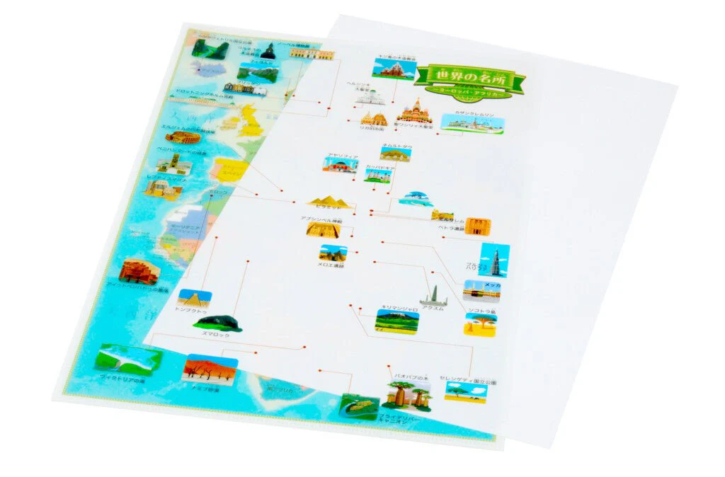
With ruby annotations for easy reading, these authentic world maps are accessible for children while remaining useful for adults. Choose from three educational themes: World Landmarks, World Animals, or World Flags.
With ruby annotations for easy reading, these authentic world maps are accessible for children while remaining useful for adults. Choose from three educational themes: World Landmarks, World Animals, or World Flags.
Key Features
- Four A4 clear files per set: Divided into Europe/Africa, Asia/Oceania, North and South America, and Europe (enlarged) regions.
- Color-coded maps: Countries distinguished by color with country names, capital names, mountain ranges, and rivers labeled.
- Ruby annotations: Pronunciation guides make maps easy to read for children and learners.
- Three educational themes: Available in World Landmarks, World Animals, or World Flags designs.
- Family-friendly learning tool: Authentic world maps suitable for children through adults.
- Individually packaged: Each set comes in protective packaging.
| Dimensions | 310 × 220 mm (A4) |
|---|---|
| Material | PP |
| Sheets per Set | 4 sheets |
| Regions Included | Europe/Africa, Asia/Oceania, North and South America, Europe (enlarged) |
| Packaging | Individual packaging |
| Made in | Japan |
Select Design
From $0.18
Original: $0.59
-69%Clear File World Series 4-Sheet Set / Tokyo Cartographic—
$0.59
$0.18Product Information
Product Information
Shipping & Returns
Shipping & Returns
Description
The Clear File World Series 4-Sheet Set by Tokyo Cartographic brings educational world geography to A4 clear file folders designed for learning about countries, landmarks, animals, and national flags. Each set contains four clear files divided into world regions: Europe/Africa, Asia/Oceania, North and South America, and Europe (enlarged). Map sides feature color-coded countries with country names, capital names, and major mountain ranges and rivers.
With ruby annotations for easy reading, these authentic world maps are accessible for children while remaining useful for adults. Choose from three educational themes: World Landmarks, World Animals, or World Flags.
With ruby annotations for easy reading, these authentic world maps are accessible for children while remaining useful for adults. Choose from three educational themes: World Landmarks, World Animals, or World Flags.
Key Features
- Four A4 clear files per set: Divided into Europe/Africa, Asia/Oceania, North and South America, and Europe (enlarged) regions.
- Color-coded maps: Countries distinguished by color with country names, capital names, mountain ranges, and rivers labeled.
- Ruby annotations: Pronunciation guides make maps easy to read for children and learners.
- Three educational themes: Available in World Landmarks, World Animals, or World Flags designs.
- Family-friendly learning tool: Authentic world maps suitable for children through adults.
- Individually packaged: Each set comes in protective packaging.
| Dimensions | 310 × 220 mm (A4) |
|---|---|
| Material | PP |
| Sheets per Set | 4 sheets |
| Regions Included | Europe/Africa, Asia/Oceania, North and South America, Europe (enlarged) |
| Packaging | Individual packaging |
| Made in | Japan |